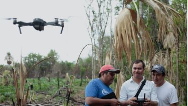
Emerging near-earth observation technologies in contested forest landscapes
How does the emergence of increasingly powerful near-earth observation technologies influence competing claims over rural land and resource governance? This project examines how technologies such as unmanned aerial vehicles (drones) and LiDAR influence claims-making in land rights struggles.

Working specifically with community organisations in Guatemala and Honduras, which are co-located with significant archaeological sites and protected areas of global importance, and whose forests have gained increasing attention for forest-based climate change mitigation, I examine how different groups make claims and contest dominant narratives through differential use and interpretation of earth observation outputs. In doing so, this project traces the multiple users and uses of near-earth observation in land rights disputes produce divergent spatial knowledges for diverse visions of development futures.
Funding: Leverhulme Trust (2020-2023)

